blah blah blah
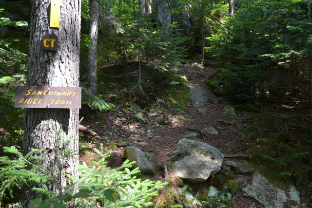
The Sanguinary Ridge
Length: 1.4 miles out-and-backDifficulty (click for info): Easy
Elevation Gain: 550 feet
Rating (click for info): 6/10
Elevation: 2100 ft
Prominence: none
Driving Directions:
Trailhead and parking area are on Rt. 26 in Dixville, NH. Parking is at the Dixville Notch Wayside, 11.6 miles east of Rt. 3, on the north side of the road
About the Hike:
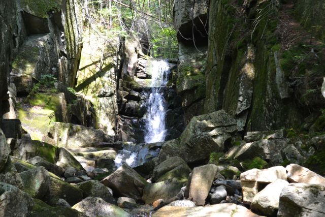
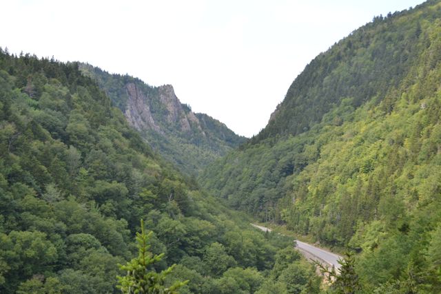
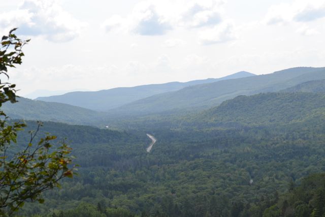
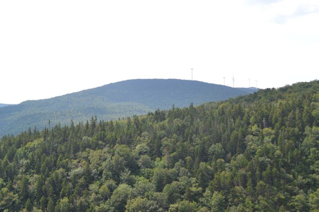
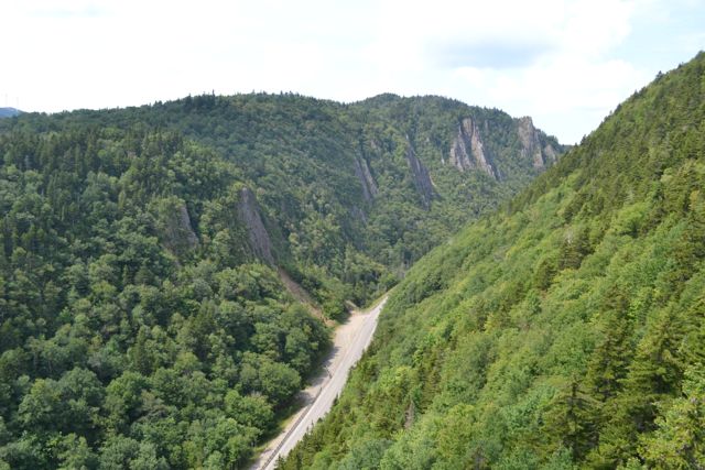
The little-known Sanguinary Ridge Trail (a link of the 165-mile Cohos Trail) starts at the Dixville Flume and passes five scenic cliff outlooks on the north side of Dixville Notch. From the parking area, a spur trail leads down to the Dixville Flume, a 20 foot plunge through a small gorge with multiple pools. The Sanguinary Ridge Trail begins to the left of the flume. It heads into the woods, passing above the Dixville Flume, and wanders gradually uphill. After passing a view backward to the nearby side of Cave Mountain, the trail reaches the first viewpoint in 0.4 miles. This viewpoint is relatively low and is not spectacular, but the effort required to reach it is minimal. An even shorter distance up the trail is another outlook. This view is significantly more interesting, as now the looming cliffs of Table Rock are visible across the notch. Dixville Peak, the highest mountain in the Dixville Notch Region, can be seen towering over you. Continuing the same distance again, a third viewpoint is reached. It is similar to the second, but now the view has opened completely to the east, revealing all of the northern Mahoosucs (in Maine).
The trail continues moderately uphill just a bit longer to the last cliff. From here, the view is again similar but higher. Now, more of the wind turbines on Dixville Peak can be seen. The Sanguinary Ridge Trail continues uphill to the highpoint of the ridge, where there is a viewpoint in a different direction (just up the Sanguinary Summit Trail), but it is limited and requires much more effort to reach. The trail leads down the other side very steeply to another cliff and ends at the access road to the Balsams. If you want to see this additional viewpoint, it may be better to drive to the other trailhead. The distance given is that required to visit the four cliffs described.
Printable directions page